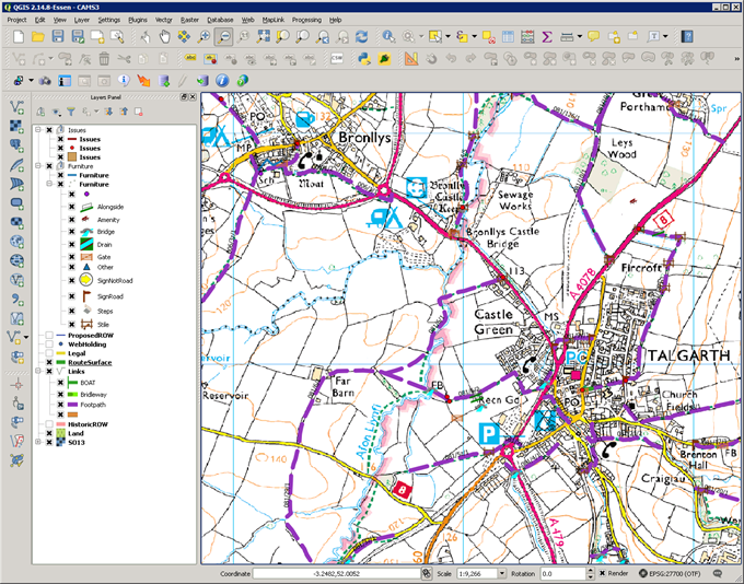
When you open CAMS, the map will always appear in its own QGIS window, usually on the right hand side of the screen. The exact view of the map will depend on how you have configured your QGIS map project. However, when displayed, the map window will be similar to the one shown below.

The Map displays the CAMS linked spatial data over the top of a base map. The objects can be labelled with their identification codes, and each type is usually distinguished by an individual colour or symbol. When CAMS is first started, the map will load in a default location.